In this Article
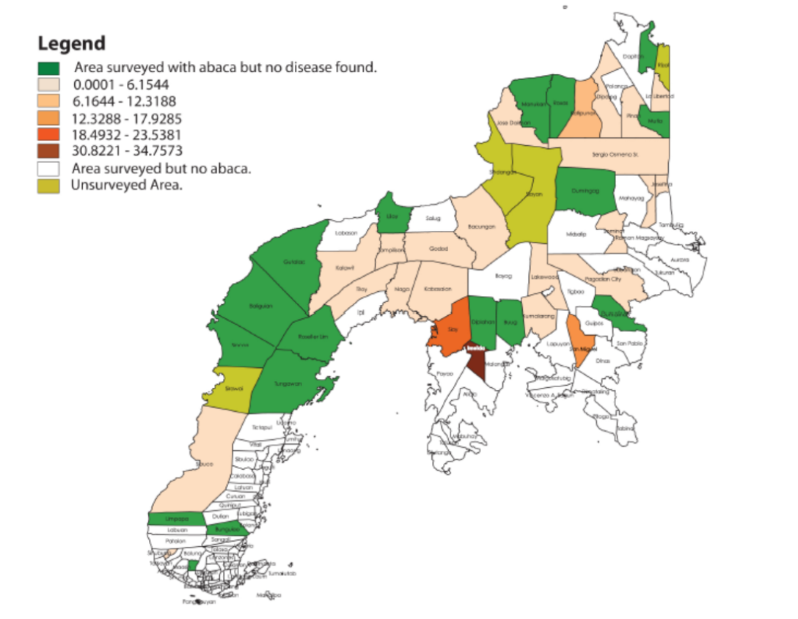
The project titled “Mapping the Distribution of Abaca Bunchy Top in Different Cropping Systems and Analyzing Epidemic Risks in the Zamboanga Peninsula” coordinated with local and municipal officials of Zamboanga, including the Department of Agriculture (DA) to conduct abaca bunchy top disease surveys, develop forecasting strategies to manage the disease, and gather data on abaca agronomic and cultural practices. The surveys, so far, indicate that bunchy top is prevalent in the Zamboanga Peninsula. From the GIS maps generated, it is clear that the areas where the disease was found are potential sources of further infection, hence the need for a strategic approach in managing the disease.

