In this Article
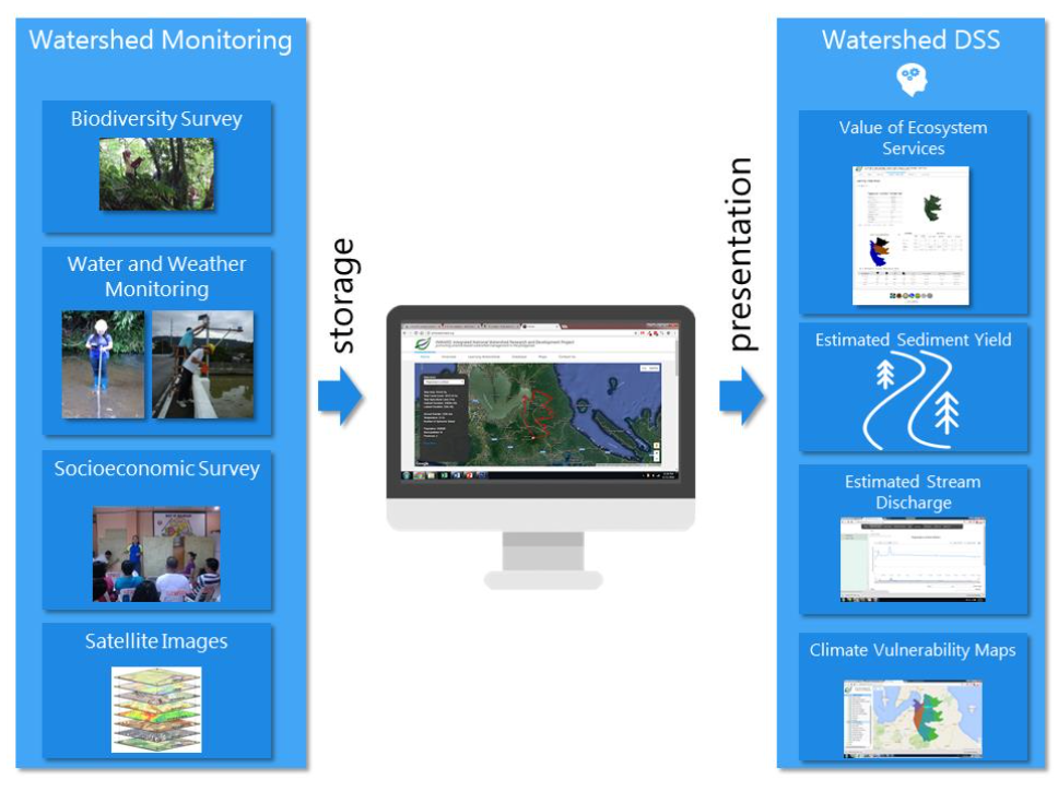
The Watershed Decision Support System (WDSS) uses modern information and communication technologies to provide support across the three main phases of decision-making: (i) he gathering of “intelligence” for identifying the need for change; (ii) “design” or development of alternative strategies, plans, or options for solving the problem identified during the intelligence-gathering phase, and (iii) the process of evaluating alternatives and “choosing”. The WDSS’s goal is to be used by watershed stakeholders as a policy and decision tool that will influence watershed planning and management, as well to be used as a scientific tool that adequately represents watershed processes that can be used for model calibration and validation.
The WDSS comprises smaller applications which use INWARD’s collected data as its basis. A database of a watershed’s basic physical, biological, and socio- economic profile serves as the foundation of the WDSS. Real-time hydrologic and weather data, socio-economic surveys, biodiversity surveys, and watershed models enable the WDSS to produce specialized information, e.g., watershed and ecosystem resiliency index, valuation of ecosystem services, and carbon neutrality indicator. These applications use images, interactive maps, and interactive graphs to present data and results that maximize the capabilities of online digital media. INWARD is also active on different social media platforms to promote online stakeholder engagement.

