In this Article

Presently, local farmers apply a certain amount of fertilizers without prior knowledge to the current soil nutrients status of their plantation. As a result, excess or shortage of soil nutrients occurs that may lead to low productivity, soil acidity or negative environmental impacts. One of the identified approaches is to improve the nutrient and water management of the farms. To provide farmers information that will lead to better decisions on improving the soil nutrient status of their agricultural lands, nutrient and water-use efficiencies need to be monitored and calculated. Nutrient dynamics needs to be assessed to come up with sound nutrient management that minimizes losses and optimum plant uptake (Umali, 2014). A similar method must be done for soil water for some crops. To help farmers in assessing soil conditions, a fast, accessible and instant but inexpensive technique must be developed.
Since the current advancements in agricultural production tackle issues on improving farm productivity, agriculture is now being revolutionized by robotics and automation. The rise of automated farming attempts to solve the issues by using robotics and advanced proximal sensing units to develop agricultural robots. Agricultural robots such as driverless tractors and unmanned aerial and ground vehicles are being utilized on different agricultural system processes including material management, field crops and forest management, soil management, dairy management, and animal management. With the efficient operation of these devices, there is an option to design an agricultural robot with an optimum configuration to assess the spatial distribution of soil nutrient in a crop plantation. An agricultural robot that measures soil nutrient status, simultaneously generates soil nutrient maps, and subsequently recommends appropriate soil management schemes is envisioned which will also offer a wide array of potential to improve the productivity of the country’s agricultural sector.
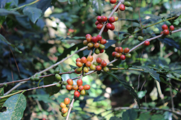
The project will develop an unmanned ground vehicle drone-aided system with vis-NIR Sensors for soil nutrient mapping of coffee farms. The technology that will be developed will allow rapid field soil monitoring, and will address the concern that soil sampling and laboratory analysis are often too time-, cost- and labor-intensive. It can therefore contribute to the efficiency of obtaining soil information data. The technology will be useful in the coffee areas and may also be utilized for other crops later.
In general, the project aims to design, fabricate and test an unmanned ground vehicle with vis-NIR sensors to operate soil nutrient measurement and mapping services in the Philippines. Specifically, it aims to:
- determine the perception and acceptance of target clientele about unmanned ground vehicle (UGV) soil nutrient analyzer;
- design and fabricate a UGV equipped with vis-NIR sensor and aided by drone;
- develop prediction models for soil moisture content, pH, organic matter, total nitrogen, available phosphorus, and exchangeable potassium;
- develop a software for the UGV vis-NIR system that integrates the developed prediction models and generates soil nutrient maps based on the measurement of the developed prediction models;
- evaluate the UGV vis-NIR system, developed prediction models, and interpolated soil nutrient maps; and
- determine the economic viability of the developed equipment.


